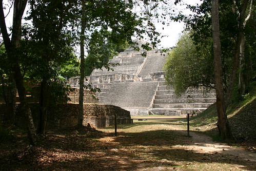
 Using NASA laser technology, researchers have discovered thousands of new structures and illustrated the complex urban centres built at the ancient Maya city of Caracol, Belize. The equivalent of 25 years worth of data (if gathered through machete-wielding means) was gathered in only four days using a technique of emitting laser beams from a plane to penetrate the thick canopy that covers the site.
LiDAR (Light Detection and Ranging) equipment brought aboard a small Cessna 337 bounced laser beams to sensors on the ground, penetrating the thick tree canopy to see ‘beyond the rainforest’, allowing for the detecting of many previously unknown features.
Until now, exploring large sites and the nature of landscape modifications by the ancient Maya civilisation was a challenging and time consuming mission. Most of the features archaeologists are looking for are hidden within heavily forested and hilly terrain and are difficult to record. 25 years of excavations hard work of removing the trees by research scientists and students alike have resulted in the mapping of some 23 square kilometres of the Caracol site.
Airborne LiDAR makes research significantly easier, and faster. The laser survey produced images of the ancient settlement and its surroundings and covered a 200 square kilometre radius in just four days. It took about 24 hours of flight time for the National Center for Airborne Laser Mapping to capture the images and then three weeks for remote sensing experts from the University of Florida to analyse the data.
 It is very exciting, said Arlen Chase, Anthropology Professor at the University of Central Florida, in a statement. The images not only reveal topography and built features, but also demonstrate the integration of residential groups, monumental architecture, roadways and agricultural terraces, vividly illustrating a complete communication, transportation and subsistence system.
The results of the LiDAR mapping are indeed astonishing: 11 new causeways, 5 new termini, tens of thousands of agricultural terraces and many hidden caves were located. The survey data was also used to confirm the previous estimates for the size of the settlement and population. The Maya city of Caracol was spread out over 177 square kilometres, with at least 115,000 residents by 650 AD.
Researchers are hoping that now Caracol’s entire landscape can be seen in 3D, it will will offer new understanding of how the Maya were able to build such a huge empire and clues to what may have caused its destruction.
Technology is becoming more and more important in archaeology, allowing for non-invasive research and more thorough surveying.
X-ray analysis can tell us which metal alloys were used to create certain weapons, making it easier to decipher the time and date of manufacture. CT-scans, Isotope analysis and DNA analysis can teach us about ancient human remains, including their medical history and their lineage, and scientists have now even unlocked the Neanderthal genome. Ground penetrating radar (GPR) allows archaeologists to detect and map archaeological remains without putting a shovel into the ground and robot explorers are send down pyramid shafts too narrow for man to access, let alone excavate.
Our favourite technological innovation, which is used more and more frequently in archaeology and history research, is 3D modelling. These projects utilise data gathered by surveying projects such as those of the Great Sphinx, the catacombs in Rome, ancient skulls and the landscape around Stonehenge (a LiDAR survey as well), or even data crowd-sourced from Flickr. The digitalisation of our heritage keeps information (at least dimensional and textural information) safe for the future. It also allows for easy access to whoever needs or desires it, be they archaeologists using specialised gear such as VR-systems to ‘dig virtually’, or members of the public who want to explore history in a virtual environment such as our King Tut & Stonehenge Virtual or Giza 3D, which will hopefully be released soon by the Giza Archives Project and Dassault Systemes.