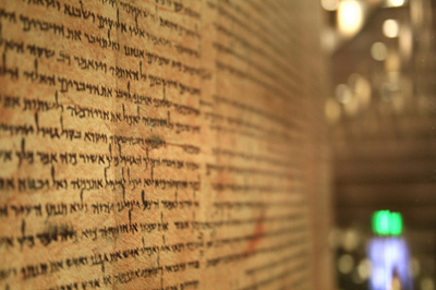
The US military has been heavily criticised for its disregard for Iraq’s heritage sites since invading the country in 2003 – ancient minarets have been bombed, precious artefacts allegedly looted at the National Museum, and a full scale camp, including a helipad, constructed slap bang on top of Babylon. As part of a recent drive to demonstrate renewed sensitivity for the Cradle of Civilization’s venerable past, a US Army sergeant has set about creating a detailed map accurately pinpointing as many of Iraq’s estimated 1,200 archeological hotspots as possible.
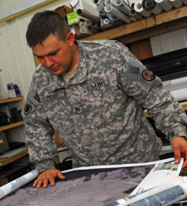
Sgt. Ronald Peters is a geospatial analyst with Multi-National Corps-Iraq C-7, based at Fort Lewis, Washington. His unit specialise in creating bespoke maps for specific scenarios, by extracting certain features from one and combining it with features from another, to make a new map. A map showing structures and roads, for instance, could be combined with another map showing soil types, to create a new chart ideal for use by farmers planning irrigation systems.
Presently, with the US military commitment in Iraq downsizing and redeploying, there’s a strong need for units to be able to shift and encamp at new locations at short notice safe in the knowledge that they aren’t setting-up on ground of archaeological significance. A request was placed with the Fort Lewis geospatial analysts to create a single, specialised map for just such a purpose; Sgt. Peters – a social science major – eagerly volunteered for the task. He’s been working flat-out on it since, sometimes sitting up as late as 5am pouring over scans, maps and the internet for clues.
“It’s fun,” he told DVIDS – the international media outlet for US forces serving in the Middle East. “I love doing it… history and geography are two areas that have been two of my academic passions.”
“Everybody knows this is the cradle of civilization,” he added. “There’s Babylon, Ur, some pretty famous archeological sites in Iraq.”
A 1961 map of Iraq created by the Iraqi director of Antiquities, locating 270 different rock monuments, cultural and historical sites, served as a decent starting point, although it required some updating – Ctesiphon, for instanced, was pinpointed about 50 miles away from its actual spot. “The mapping software we have is a lot more accurate than what they used 48 years ago,” Sgt. Peters explained.
Diane Siebrandt, an archeologist and cultural heritage officer at the US Embassy in Baghdad, proved another important source. She shared information from the State University of New York. “They had a project of about 700 sites,” said Sgt. Peters. “I compared that to the 300 sites I had and most of them were confirmed by the SUNY list and other research.”
Right now, Peters is up to 800 sites total. The golden number of 1,200 comes from an Arizona State University project list of sites to be mapped and presented to the State Board of Antiquities and Heritage of Iraq. It seems unreachable, but Sgt. Peters remains positive that his chart is still highly functional. “It would be nice to get all 12,000,” he said, “but there’s no possible way for us to do it, so right now what we’re mainly concerned about is anything within where we are going to be operating, doing the best that we can not to infringe on any sites.”
The mapping project follows news that US units serving in the Middle East are to begin receiving cultural heritage training. It also comes after a heated conversation took place at the World Archaeological Congress in Dublin in July on the topic of whether it would be responsible for archaeologists to help the US military – or other nations’ armed forces – to plan strikes against a foreign adversary (such as Iran), so as to avoid damage to important heritage sites.