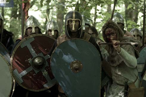
Derry Brabbs is a well known UK photographer who has published nine books as photographer and author. He has also collaborated on 18 other books with other writers as photographer in his 25-year career to date. He is particularly interested in blending the story of England’s heritage with its landscape. Brabbs worked with the inimitable fell walker, Alfred Wainwright, on many books and told Heritage Key in December 2009 that he started to photograph Hadrian’s Wall in his first assignment along the Roman frontier with Wainwright in 1984.
Brabbs’ Hadrian’s Wall can be classified as a ‘coffee table book’ as its photographs are luscious. The right amount of history and words are juxtaposed alongside the images. Interestingly Brabbs decided to shoot the Wall from west to east whereas many of the guidebooks about Hadrian’s Wall begin at the opposite direction. As Brabbs says in his introduction, he wanted to finish the Wall in Wallsend and that “it is far easier and more comfortable to walk with the prevailing wind and weather on one’s back, rather than battling head-on against it”.
(I can see his logic on this latter point, although I can testify that the wind can change direction several times even in the course of one day whilst out walking the Wall.) Thus Brabbs takes in the West, the fabled Central section and then onto the Eastern part that finishes at Wallsend.
A History of the Romans in Britain
He gives a short introduction on why the Romans came to Britain and how they made their advance through the island. He gives a striking example of a Roman lighthouse (a pharos) which stands within the walls of Dover Castle in Kent and talks about the development of the Roman road system (eg Dere Street) to show how the Roman Empire grew and extended to northern Britain and beyond. On page 15 he shows the ‘stanegate’ (the pre-Roman term for a stone road) supply route which leads up to the doors of Vindolanda. (Vindolanda was a Roman fort built 35 years or so before Hadrian’s Wall, and the stanegate originally ran from Carlisle to Corbridge and possibly over to Newcastle.)
Brabbs also sets out how the Wall was initially built and recounts how changes were made to it over the course of its life (the text and photos, in particular on pages 54/55, 57 and 59, reveal the stubbornness and quirkiness of Roman building methods). He details how Hadrian’s Wall came to be rediscovered in the last few hundred years by antiquarians and then goes on to show which bits of the Wall are still in existence today.
Exploring the Unexplored
There are some lovely touches: Brabbs mentions and photographs Whitley Castle Epiacum fort, which is south of the Wall near Alston on the old Roman Maiden Way (and Pennine Way). He does the same with his visit at Bewcastle Roman Fort (Fanum Cocidii). Neither of these is often written about, indeed they are still largely unknown to those who are familiar with the Hadrian’s Wall trail.
This is a great ‘starter’ book for anyone becoming interested in Hadrian’s Wall. The original idea for the book was a ‘year in the life of Hadrian’s Wall’. That idea changed somewhat and this book was produced in time for the British Museum’s exhibition on the Emperor Hadrian which took place in 2008. Whilst I appreciate the book was rushed out in time to coincide with the exhibition, I felt its editing could have been a bit tighter in places.
The landscape around Hadrian’s Wall is fabulous and, naturally enough, Brabbs’ pictures of the area are stunning. I heartily recommend the book to newcomers to the Wall and the region; I also recommend it to anyone walking the Wall for the umpteenth time – it would be an excellent book to consult before/during/after any walk along any part of the Wall. For a hardback priced at £14.99, it is good value for money.