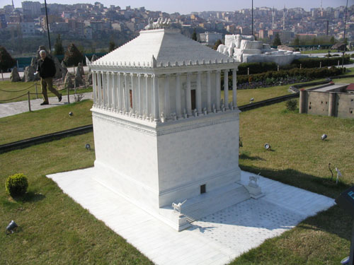
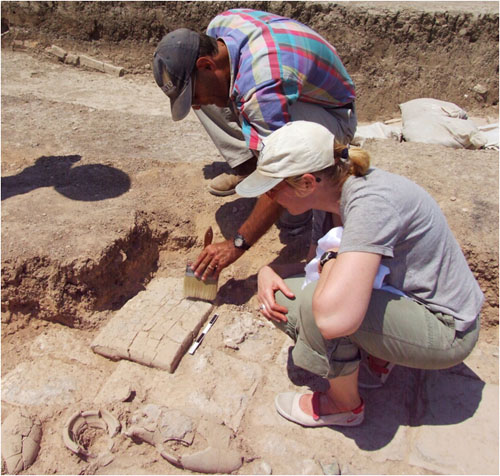
Category: owenjarus - Part 2

‘Huge’ structure discovered near Snefru’s Bent Pyramid in Egypt may be an ancient harbour

An excavated portion of the newly discovered 140 meter causeway. It connects the U-shaped structure to one of the Bent Pyramid's temples. The structure has three meter high walls. Image copyright the German Archaeological Institute.Archaeologists have discovered a large structure to the northeast of the 4,600 year old Bent Pyramid which may be the remains of an ancient harbour. It connects to one of the pyramids temples by way of a 140 meter long causeway.

The discoveries were made by a team from the Cairo department of the German Archaeological Institute, and the Free University of Berlin. The team used magnetic survey and drill cores soundings to make the finds. The structure is mostly unexcavated and only a portion of the causeway has been unearthed.

The structure itself is U-shaped, 90 meters by 145 meters. It was built with mud brick and has no wall on its east side. Maybe this structure can be interpreted as (a) harbour or something like that, said Dr. Nicole Alexanian of the German Archaeological Institute, Cairo. She said that it may have been beside water, its possible that ships could enter by a canal in this area.

Harbours are known from later Egyptian pyramids and may have served as a receiving point for the body of the pharaoh. It is unlikely, however, that the newly discovered structure was used for the burial of the Bent Pyramids creator the pharaoh Snefru. It is widely believed by Egyptologists that his final resting place was the Red Pyramid, located two kilometres to the north of the Bent Pyramid.

Click the imagesto seea larger version.

Snefru was the first ruler of the fourth dynasty and constructed two pyramids at Dahshur (the Bent and Red Pyramids), one at Meidum, and one at Seila. These were the first true pyramids those with smooth sides. After he died, his son Khufu inherited the throne and began construction of the Great Pyramid at Giza.

A 140 meter roofed causeway

The causeway runs due east of the temple and has a vaulted roof. This appears to be the earliest known instance in which a roofed causeway was used in an Egyptian pyramid complex.

The walls – they built them to a really astonishing height, almost three meters, said Dr. Alexanian.It was like a tunnel – astonishingly its also very steep.

The interior of the causeway contained a passageway more than 2.5 meters wide. Its walls were lined with undecorated white and yellow plaster which appears to have been maintained for a long time.

Four phases of the plastering could be distinguished which attest that it was renewed several times, said the team in a recent report. From (the) state of weathering of the different plaster layers it can be inferred that the causeway was used for a substantial period of time i.e. at least 40 years.

Building the Bent Pyramid

Archaeologists are not certain why Snefru went to the trouble of building four pyramids in Egypt. The Bent pyramid, as its name suggests, has an odd angle with a slope that looks like it was changed part way through construction. It has been suggested that this was an error made by workers trying to grasp new construction techniques.

However research done by the German team suggests that the geology of the plateau played a role in the pyramids odd shape.

The ground had to be stable this was a problem with the Bent Pyramid, said Dr. Alexanian. The ground where the Bent Pyramid is built on, its not always stone, there was some taffla. Its something like muddy structures in the ground.

This affected construction. Therefore they got problems doing the ground, therefore they altered the angle of the pyramid.

Flattening the plateau

There is also evidence that the pyramid builders altered the plateau to make it flatter quarrying material from the east. The team writes ina conference abstract that the topography of the pyramid plateau can be hardly explained taking into account only fluvial processes or processes like gully erosion or soil erosion.

Therefore, for the area of the pyramid plateau a direct anthropogenic relief forming influence has to be considered. In other words humans altered theshape of the plateau.

Alexanian said that flattening the plateau would make the view from the cultivated area even more dramatic. People would have seen a flat, sharply edged, plateau, with a pyramid built on top and possibly a canal leading up to it.

A sight that would make someone living 4,600 years ago gasp in awe.

‘Huge’ structure discovered near Snefru’s Bent Pyramid in Egypt may be an ancient harbour

Archaeologists have discovered a large structure – to the northeast of the 4,600 year old Bent Pyramid – which may be the remains of an ancient harbour.  It connects to one of the pyramid’s temples by way of a 140 meter long causeway. The discoveries were made by a team from the Cairo department of the German Archaeological Institute, and the Free University of Berlin. The team used magnetic survey and drill cores soundings to make the finds. The structure is mostly unexcavated and only a portion of the causeway has been unearthed. The structure itself is U-shaped, 90 meters by 145 meters. It was built with mud brick and has no wall on its east side. “Maybe this structure can be interpreted as (a) harbour or something like that,” said Dr. Nicole Alexanian of the German Archaeological Institute, Cairo. She said that it may have been beside water, “it’s possible that ships could enter by a canal in this area.”

Nefertiti and the Aten in Colour! 16,000 Amarna Art Talatat blocks in Luxor with Original Pigment Preserved

Archaeologists are examining a cache of talatat blocks in Luxor that depict Amarna period art in their original colour. “The amount of detail which is shown, where the colour had been preserved, it’s just amazing,” said Dr. Joceyln Gohary. “Some of the most striking details are in the clothing – particularly of the queen, Nefertiti – details of the dress and jewellery that she’s wearing,” she said. Dr. Gohary is leading an American Research Center in Egypt (ARCE) project that is documenting, cleaning and conserving them.

19th Century Manuscript and Drawings by Egypt Explorer Frédéric Caillaud Discovered

An unpublished manuscript, written by 19th century Egypt explorer Frdric Caillaud, has been discovered and it points the way to a 3,500 year old tomb of an Egyptian official.

It is called Arts and Crafts of the Ancient Egyptians, Nubians and Ethiopians. It iswritten in French and illustrated with drawings. The American Research Center in Egypt (ARCE) is in the process of translating and publishing it. The work is being led by Dr. Andrew Bednarski. He gave a lecture and interview recently in Toronto, and provided me withsnippets from the bookand pictures ofthree of the drawings.

Frdric Caillaud was one of the first Europeans to reach the ancient city of Meroe, far up the Nile and inside modern day Sudan. He also explored sitesin Thebes and the Kharga Oasis, and re-discovered the ancient emerald mines of Mount Zabarah. His published books include Voyage to Meroe and Voyage to the Oasis of Thebes (both originally written in French). The expeditions he undertook happened between 1815 and 1822.

The newly discovered manuscript includes four drafts of the book, plus notes about 1,000 pages in total. The focus of the work isnt so much on the adventures Caillaud had rather its on his efforts to make sense of the things that he saw.

Work on the book did not go smoothly. To say that there were problems with publication is a bit of an understatement, said Dr. Bednarski. Half of theimage plates were lost when the house they were in was destroyed. It actually collapsed. Some of these drawings later appeared in other works. Despite the setback Caillaud kept working on the text, reaching the fourth draft before he passed away in 1869.

“We could not destroy one of the most beautiful monuments of ancient Meroe.”

At that point his son got the documents and they vanish from the historical record. Its not until 2002 that they re-surfaced at an auction house in the southern United States, where it was purchased by Christine Thomson and Rupert Halliwell. In 2005 it came up for auction again, this time at Christies in London, and long-time ARCE member Dr. W. Benson Harer Jr. made the purchase. In 2008 ARCE initiated the publishing and translation project.

Readers may note that one of the drawings, shown above, is particularly interesting.It appears todepicttwo dogs thatareboth wearing collars. The drawingis fromthe tomb ofNeferhotep (an Egyptian official).The tomb’slocation is unknown to present day archaeologists and, untilit is found, it cannot be confirmed that Caillaud’s drawings are accurate.

Directions to the tomb of Neferhotep

Neferhotep was an Egyptian official who was buried in Thebes. He was an overseer of the granary, said Dr. Bednarski, probably during the reigns of Amenhotep II and/or Thutmose III. This makes the tomb about 3,500 years old.

We just have no idea where that tomb is all together, said Bednarski.

Thats where the book comes in.In the manuscript theres a plan (of the tomb), of which Ive just found, said Bednarski.My focus is to go back this summer to the Theban west bank.”

Once there “Im going to try to find it based on the references that he makes in his manuscript, but based primarily off of a plan that hes drawn of the tomb itself.”

So how is it that this tomb became lost after Caillaud discovered it?

Any number of things could have obscured the entrance, said Bednarski, including landslides. One of the other possibilities is that simply all the decoration had fallen off the walls, or been robbed out, and as a result theres no way of identifying it as having been there.

Exploring the Pyramids of Meroe

The book includes accounts of exploring the pyramids at Meroe and elsewhere in Sudan.

Take a look:

In April 1821, Mr. Letorzec and I were climbing[a]pyramid…Prince Ismail expressly forbid us from all excavations, not wanting to be treated, he said, as impious by the natives, in violating the sepulchres. In any case, we could not destroy one of the most beautiful monuments of ancient Meroe.

[Arts and Crafts, chapter 14]’

Heres another account:

We regretted not being able to penetrate the tombs of Meroe and Napata where we might have found, as in those of Egypt, scenes of private life for the ancient people. We saidthat at the time of my discovery of these monuments in April 1821, Ismail, son of Mohammed Ali, fearing to pass before the eyes of the natives for authorizing the violation of the tombs, expressly forbade us from any attempt to penetrate them.

[Arts and Crafts, chapter 2 footnote]’

A discovery in Thebes

The book also includes this account of a discovery in Thebes:

Finding ourselves in 1816 in the ruins of the Theban Necropolis with Consul Drovetti, we collected a large, wooden statuette with a height of 60 centimetres, representing Osiris. It was fixed to its base with a dowel which we had the curiosity to remove. The idol separated thusly from its base and, to our great surprise, we found in the body itself a magnificent roll of papyrus, measuring 3 metres 50 centimetres in length. The thickness of the bottom of the legs of the statuette had caught our attention. We might believe this beautiful funerary ritual was thusly hidden, forever and a day, in the body of the great god Osiris. We give notice to the directors of the Egyptian Museum who might not have known this.

[Arts and Crafts, chapter 17 footnote]’

A 19th century encyclopaedia

In general the book is written in the style of a 19th century encyclopaedia, said Dr. Bednarski, with individual sections for each topic. However Caillaud didnt understand Egyptian hieroglyphs so he had to make his interpretations without them.

In the entry below he describes what funerary papyri, buried with the deceased, are for:

They represent the transmigration of the soul at its return to the divine, judgment scenes, etc, in which good or bad actions are weighed under the eyes of Osiris, the god of the Amenti, who declares judgment. The souls of the guilty take the form of a trout, a wolf, or other animals known to be impure, to be thusly returned to earth.

[Arts and Crafts, chapter 17]’

19th century analogies

Caillaud also uses 19th century analogies to try to explain things he sees in Egypt. In this excerpt he notes that the Egyptian custom, of balancing a pole on a persons shoulders, isalso seenin Holland:

We have noted that this custom is much appreciated in Amsterdam, principally during the period where ice overruns the canals which, as we know, become in this circumstance the roads for the country. The milkmaid on her skates has a balancing pole on her shoulders from which her containers or her baskets of vegetables are suspended. They follow each movement of the courageous Dutchwoman, who sometimes on one foot, sometimes on the other, indulges in the full dash of her skates. For foreigners (and we remember) this fact is one of the curiosities of this country.

[Arts and Crafts, chapter 5]

Click To Watch Video
The Lost Tombs of Thebes (Featuring Dr Zahi Hawass and Dr Janice Kamrin)
On a journey through the Tombs of Thebes, Dr Zahi Hawass and Dr Janice Karmin explain the ongoing discoveries being made in the area, and how there are thousands upon thousands of “Lost Tombs” just waiting to be found!

The last discovery of Frdric Caillaud

If all goes well we should know soon whether the manuscript leads the way to the tomb of Neferhotep. While the tomb wont be as large as one built for a pharaoh or prince the potential of re-discovering the artwork inside is a tantalizing one.

Caillauds life suggests that he was a man who loved discovery and wasnt afraid to announce it. When he encountered a temple in the Kharga Oasis he could not resist the urge to write an inscription commemorating the find. He wrote that Caillaud was the first European who learned of this temple year 1818.

Now, in the year 2010, the noted explorer is set to make one last find.

Check out Dr. Zahi Hawass and Dr. Janice Karmin talking about Lost Tombs of Thebes in this Heritage Key video.

Mummies in Milwaukee! Mummies of the World coming to Wisconsin in December

The mummified head of a middle-aged man who lived in Egypt during the Roman period, still half-covered in bandages. The skull contains desiccated embalming substances, but no soft tissue. Radiocarbon analysis establishes its age as c. 2025 years BC. Picture credit - American Exhibitions, IncThe good citizens of Milwaukee are set for a mummifying experience.

From December 17, 2010 to May 20, 2011 the exhibit Mummies of the World will be hitting the Milwaukee Public Museum. The exhibit features 150 human and animal mummies showcasing mummification practices from around the world.

The ‘Mummies of the World’ touring exhibit is currently on at the California Science Center.

Egypt is famous for its mummies, but the practice is seen in many other cultures. The bogs of Northern Europe allow for mummification, as does the hot arid climate of Peru. Mummification techniques have even been used in modern times Lenin being perhaps the most well-known example.

The exhibition will feature many examples. They include animal mummies from Ancient Egypt, an embalmed 4,500 year old Peruvian baby known as the Detmold Child and the mummy of Baron Von Holtz a 17th century noblemen thought to have died in the thirty years war (1618-1648).

Mummies of the World will give a broad overview of natural (spontaneous, such as the5,300-year-oldItalian Otzi the Iceman) and anthropogenic (artificial, the most famous example being the mummy of Tutankhamun)mummification in all its many forms, and consequently provide viewers with an educational and scientific window into the cultures, history and lives of people who came before us.

If youre looking for something to tide you over, until then,check out Chasing Mummies, a new reality show starring Dr. Zahi Hawass.It features plenty of wacky Egyptology action. Heritage Keys Jon Himoff has been following the venture closely.

Ancient Stone Monument to Napi Discovered on Canadian Prairies

A stone effigy monument, in the shape of a Blackfoot creator god named Napi, has been discovered in southern Alberta south of the Red Deer River near the hamlet of Finnegan.

One day Old Man determined that he would make a woman and a child; so he formed them both the woman and the child, her son of clay. After he had moulded the clay in human shape, he said to the clay, “You must be people …

They walked down to the river with their Maker, and then he told them that his name was Na’pi, – Old Man.

-From Blackfoot Lodge Tales, George Grinnell, 1892

The Blackfoot are a people that have inhabited the prairies since ancient times. The effigy dates to somewhere between AD 1000 and AD 1500. It would have been constructed before the time of European contact.

Napi is a deity credited with creating the Blackfoot people and the landscape they inhabit. According to Blackfoot tradition hes like the creator, said archaeologist Meaghan Porter, who investigated the site.

She said that the imageis made out of rocks and its in the outline of a man it has arms and a torso, head and legs as well as genitalia. Itsroughly five meters by five meters long. Therocks are about the size of a fist, they have a mix of black, grey and tan colours. Porter doesn’t think these colours were chosen deliberately I think thats just the rocks that were available,shesaid.

Some of the rocks have been fire-broken. This means that they have a red color and are fractured apart and jagged. They look like this because someone, back in antiquity, exposed them to heat whether this was done for religious reasons is unknown. Im not entirely sure, said Porter, again, it could just be that those were the rocks available.

Only nine stone effigies like this have been documented in all of Alberta.

Why was it created?

Archaeologists have found other sites near the area. One of them is a camp, located about one kilometre away, which is about 400 meters by 400 meters in size. Archaeologists found bone remains, hearths, more fire broken rock and even obsidian material that comes from a volcano.

“As he lay on his back, stretched out on the ground, with arms extended, he marked himself out with stones”

My hypothesis currently is that this Napi effigy (is) kind of a central focal point for other sites the area is significant, said Porter.

Blackfoot stories mention effigies like this. In 1892 anthropologist George Grinnell published a story about Napi, that he –

Made the Milk River (the Teton) and crossed it, and, being tired, went up on a little hill and lay down to rest. As he lay on his back, stretched out on the ground, with arms extended, he marked himself out with stones,–the shape of his body, head, legs, arms, and everything. There you can see those rocks today.

A vulnerable site

The site is quite vulnerable. Sadly some of the rocks had already been moved from their original location by thetime the effigy was documented.

Themonument could easily be destroyed if more of the rocks were moved. As such the team has been cautious about not releasing information or pictures that will give away its precise location. They did release a diagram that shows what the site looks like its pictured here. Porter also published an article about the find in the journal Alberta Archaeological Review and discussed the work at the 2010 Canadian Archaeological Association annual meeting.

The person who reported this find, a rancher, is also very protective of the site. He was concerned that energy development in the area might affect it. The ranchers grandparents, who homesteaded in the area told him to watch over the effigy, wrote Porter in her journal article. The energy company, EnCana, decided to stop development and even agreed to finance the mapping and study of the site. It is now protected under Alberta heritage law.

Archaeologists discover ancient ivory maskette on Canadian Arctic island

The Tunit made our country habitable. They built the line of boulder cairns that guide caribou to the river-crossings where they can be ambushed by hunters, and they furnished the rivers with fish-weirs. An Inuit story, from Ancient People of the Arctic by Dr. Robert McGhee

Today archaeologists believe that the Tunit, who are mentioned in Inuit stories, flourished in the arctic during ancient times, vanishing around the 14th century AD.

Archaeologists first encountered their remains in 1925 at a place called Cape Dorset on Baffin Island. They gave them the name Dorset culture, a term that is still used today.

The Dorset developed special technologies that allowed them to survive in the harsh arctic environment. They used harpoons and lances to hunt down walrus and other animals. They constructed semi-subterranean houses made of stone and sod, to shelter themselves from the elements. To improve their tool repertoire, they obtained pure iron from meteorite remains at Cape York in Greenland pounding them with heavy rocks to remove flakes that could then be hammered into an edge.

Recent research, conducted by Dr. Patricia Sutherland, suggests that the Dorset even developed a trading relationship with the Norse who appeared in the Arctic around AD 1000.

Why they vanished is a mystery. Climate change, which warmed the arctic, may have been a culprit. An eastward migration of the Thule (ancestors of the Inuit), around AD 1000, could also have played a role. It has even been suggested that the Dorset succumbed to diseases brought to North America by the Norse. A fate that would be shared by other Native American groups hundreds of years later, after Columbus landed in the New World in 1492.

An ancient maskette

The Nuvuk Islands lie off the northern tip of Quebec, close to the modern day settlement of Ivujivik. A team of archaeologists from the Avataq Cultural Institute and Laval University, including nearly a dozen local high school students learning about archaeology, have been exploring the islands.

They have uncovered two Dorset houses, each of them nine meters long,that date to somewhere between 1,500 and 800 years ago. Constructed of stone and sod they were sunk partly into the ground to help insulate them.

One of the most intriguing artefacts theyve found is a5 centimetre long ivory maskette thatmay have been used by a shaman a person who would have connected the people with the spiritual world. Its the first complete maskette found in northern Quebec (an area also known as Nunavik) in more than 50 years.

Its quite possible that it had some kind of shamanic connection, there was some kind of religious or spiritual side to it, said archaeologist Susan Lofthouse, in an interview with Heritage Key.

It has a holenear the topwhich means itprobably would have been worn like an amulet. It was cut out of walrus ivory and crafted with great skill as shown by the small details.

Two nostrils (representing the nose) are cut into the centre. Mouth, ears and eyes were also depicted. The maskette has an x-ray motif lines that run across it. Its something commonly seen in art from this time period.

A lady from Nunavik suggested to me that the lines represent tattoos indicating that the face represents a woman, wrote Lofthouse in a recent paper.

There is more evidence that this maskette represents a woman.

At the top of the mask there is a round shape that looks like a bun. Historically Inuit women would wear top knots on top of their heads, said Lofthouse. Their hair would be kind of tied up into a bun on top of their head it looks quite similar to that.

So couldthis maskettehave been used by a female shaman? Traditionally shamans were more often men (however) there have been accounts of female shamans, said Lofthouse. It could have been related to magic that pertains to women.

Hunting walrus in the open ocean

To obtain the ivory for the maskette, the people would have hunted walrus going out on the Arctic Ocean to do so. As far as we know the Dorset only had small skin boats, like kayaks, Lofthouse said. Definitely it could have been dangerous.

The walrus would have been used for more than its ivory. It would have been consumed along with other animals such as seal, caribou and seabird. Bone remains from all these species have been found on the site.

To aid in hunting, the Dorset developed harpoons that would have been used to kill and bring in the animals.

So important was the harpoon that the Dorset even created a miniaturized version of them, examples of which have been found on site. Only a few centimetres long, these tiny figures were definitely not for practical use, said Lofthouse. Rather they probably were something like hunting amulets for good luck.

Hips don’t lie! New technique to determine a skeleton’s sex

Somewhere in the world bones from an ancient skeleton are discovered buried in an unmarked grave.

The head is missing, most of the chest is gone and only a small fragment of the pelvis has survived.

Researchers are then faced with a problem how do you tell if this person is male or female? The pelvis holds the answer, but only a small amount of it is left.

Today a team of researchers lead by John Bytheway and Ann Ross, from North Carolina State University, and Sam Houston State University, announced a solution to thisproblem – in the form of a paper published intheJournal of Forensic Sciences.

The researchers have been studying the human pelvis and have identified 20 anatomical landmarks that differentiate males from females. Finding so many of them is important. Even if only a small portion of a pelvis is found, odds are that at least a few of theseanatomical differenceswould be identifiable.

Forensic scientist would use a digitizer to create a 3D map of the pelvic fragment and measure the relevant anatomical landmarks, reads the university news release. The scientist could then determine the sex of the remains by comparing those measurements to the measurements listed in the paper.

Voila! You know whether youre dealing with a he or a she! The techniquewill also be useful in dealing with modern day mysteries such as people who have been killed in a plane crash.

Biggest of the Dead Sea Scrolls was created at Qumran

The debate over the origin of the Dead Sea Scrolls may end up coming down to a very basic element water.

The Dead Sea Scrolls were discovered in the 1940s and 50s near the site of Qumran in the modern day West Bank. Its a mystery as to how they got there.

Recent archaeological work by Yuval Peleg and Yitzhak Magen suggests that Qumran had nothing to do with the scrolls. It was first used as an outpost by the Hasmonean army and later became a centre of pottery production. They suggest that the scrolls were deposited in the caves by people fleeing the Roman army, after the siege of Jerusalem in AD 70.

On the other hand virtual reality research conducted by Dr. Robert Cargill, of UCLA, suggests that the residents of Qumran could have created some of the scrolls. They did this while carrying out other tasks such as animal husbandry and pottery making.

Now a team of scientists has some new evidence to bring to this discussion.

They claim to have identified the origin of the longest of the Dead Sea Scrolls (known as The Temple Scroll) by identifying the source of the water used to make the parchment.

The team is based in Italy and is made up of researchers of the National Laboratories of the South (LNS) in Catania of the Istituto Nazionale di Fisica Nucleare (INFN, Italy’s National Institute for Nuclear Physics). One of the team leaders, Professor Giuseppe Pappalardo, presented the results yesterday at a conference.

The team analyzed the ratio of chlorine to bromine in fragments of the Temple Scroll. They then compared this ratio to that of the water sources near Qumran.

According to this analysis, the ratio of chlorine to bromine in the scroll is consistent with the ratio in local water sources, said the team in a release. (It) may have been made near the Dead Sea, in the area of Qumran, where the scrolls were found. In other words, the scrolls may have been created locally.

Its a cautious statement and the team added that more testing needs to be done. The next step in the research will be to analyse the ink used to write the scrolls.

It should also be pointed out that the temple scroll is just one of hundreds found in the caves near Qumran. Just because this scroll was made near Qumran does not mean that they all were.

Chinese president Hu Jintao may kick-off Terracotta Warriors show in Toronto

A Toronto newspaper is reporting that Chinese President Hu Jintao may kick-off the Terracotta Warriors exhibit, at the Royal Ontario Museum, on June 26.

It will be the largest Terracotta Warriors show ever displayed in North America featuring 250 artefacts in total including 16 human terracotta figures. It’s opening day coincides with the start of the G20 summit in Toronto, which the president will be attending.

The Toronto Starreports that the president and his wife Liu Yongqing have been formally invited by the museum. Were hoping, but we know there are lots of things on their agenda, exhibit curator Dr. Chen Shen, told the newspaper.

There is no reason in the world to close. Its perfectly safe up here for our public and our staff

In the same article museum officials defended their decision to open the exhibit while the summit is running. Other venues in Toronto have decided to shut down. These include the Art Gallery of Ontario, the CN Tower and the University of Torontos St. George campus (which practically surrounds the museum).

There is no reason in the world to close. Its perfectly safe up here for our public and our staff, the Toronto Star quotes Dr. Dan Rahimi as saying. He is the vice-president of gallery development. The city is going to be a ghost town, so let people come to the ROM.

When contacted by Heritage Key several weeks ago the museum declined to comment on what special security precautions they will be taking.